5thGenRams Forums

Register a free account today to become a member! Once signed in, you'll be able to participate on this site by adding your own topics and posts, as well as connect with other members through your own private inbox!

Boogielander Build

Could you expound on this statement? What do you find deficient with your current setup?
my current setup is fine but a 2500 with a longer bed would be great lol
(and the goal was to end up with a power wagon because Carli Dominator Kit. I want to be able to eat raptors for lunch in the desert while go play in Moab with my crawler friends)

the only time when I find my current setup not good enough is like tonight. when it's muddy, cold, wet, and windy outside in bear country. that's when an expedition truck with hard body or a van comes in. no need to mess around outside before getting into the camper lol

BUT when i'm on the "trail" and passing these vans and expedition trucks left and right, it was the greatest feeling ever lol
 
Day 24 - Hello again, Yukon
Well, today we got on the last leg of Alaskan portion of the trip.
Leaving Tok with full tanks of gas and diesel, I felt part of me was left behind in this magical place as I pointed the truck east.
Before long, we got to Teslin Junction and hang a left to head north on Taylor Highway.
IMG_8845.jpg
Many people told me Taylor was rough. It wasn't. Not by my standard.
By lunch time, we arrived at Chicken, Alaska.
IMG_8870.jpg
Of course, gotta take a picture of the chicken with the Ram. It is a very quiet, living ghost town, and the main attractions are the chicken statues and few RV Campgrounds.
IMG_8888.jpg
Oh and the Dredge too. I didn't get the tour because it'd be so awkward to get the one on one tour LOL

Then, we were on Top of the World Highway.
There are plenty of Top of the World in US, but this is the most north Top of the World. IMG_8949.jpg
absolutely stunning. Well, stunning because of the wind chill too. It's so windy that I had to kick my door open to get out.
IMG_8952.jpg

We then crossed the border into Canada. I was trying to find the Alaska sign but no dice.
IMG_8963-2.jpg
The "highway" was really well packed.
IMG_8966.jpg
View from the driver seat.
I can never get tired of this.
IMG_8980-Pano.jpg
And then, we arrived at Dawson City.
To get to the "city" from TOTW, a ferry ride is required.
IMG_8984.jpg
And the best thing is, IT IS FREE!

Dawson City looked a lot bigger than it actually is. I basically walked the whole city in search for dinner that night, only to find the place that I was looking for was right next to my hotel LOL
 
Are the Can-Can girls performing tonight? You get dinner and a show!

I know you don't drink but check out the Sourdough Saloon and ask about the Sourtoe ****tail. I'm not sure what's more shocking, how many toes they get donated in a year, or how many they lose...and how they lose them. :ROFLMAO:

https://dawsoncity.ca/sourtoe-****tail-club/
 
Day 16 was spent in Anchorage doing nothing.
I got oil change done (basic drain and fill, and requested for 5-30 because they don't have 5-40 that I put in before the trip in the last oil change. When doing long distance driving daily, 5-40 is better simply because 0-40 is just harder to find. Turned out, the shop didn't have 5-40 and I wasn't down to wait for them to order, so 5-30 it is.

Day 17 - Welcome to the 30% Club!
Today we only have 2 places to visit: Independence Mine and Denali.

As I ascend to Independence Mine, I found this road side pull out that has an overlook.
View attachment 188409
And of course, Boogielander Cafe shot
View attachment 188408

And then we arrived at Independence Mine
View attachment 188410
It is a big campus, but compared to Kennecott there's really not much to see. There's option to rent buckets and pan to do gold panning, but I didn't try.
Most buildings are not open to public, and the mill itself was destroyed due to age.
I took Hatcher Pass down to get back to highway. Having been to Colorado and did half of Alpine Loop and other passes, I didn't really have the motivation to stop for pictures. Plus no one knew any trail etiquette at all. The beginning part of Hatcher Pass Road from Independence Mine was a 10 degree hill climb, and those coming down the hill didn't even give way to the up hill traffic.
I boogied out of there as soon as people pulled over to let me pass. Because there's something else I wanted to see. Something way more rare.

They say only 30% of the visitors to Denali get to see the mountain.
View attachment 188411
Guess who's that 30%!
The motorcyclist next to me at the viewing point said he waited 20 minutes for the cloud to pass the peak, and as soon as I parked the cloud started to move away.
View attachment 188412
Obviously, the truck needs a picture with the mountain too. (It's right on top of GFC, in case you can't tell)

I sat there and reflected my journey so far, and I've been lucky. Salmon Glacier the cloud moved away the next day, and the same happened at Denali. After a good 15 minutes, the cloud moved in again, so I continued my drive to Denali Natl Park where I had reservation at one of the campgrounds.

On the way, I saw people pulled over and were out of their cars looking at something. I passed them, looked over, and saw it:
View attachment 188413
Now I wish I got a 400x lens... I think that's a caribou. I don't think that's a moose.
Trying to get to Denali Visitor Center before they close, I got back in and started driving.
Unfortunately, I couldn't get to the visitor center in time to get my stamp, so... campground it is.
View attachment 188414
Home for the night.

That's a cow moose standing in the water. They walk through our yard a few times a month. The "log haulers" as you call them are just called logging trucks.:ROFLMAO:

I read through your entire Canada/Alaska adventure. Well done!

A few shots of the moose in our yard.

20240123_150701.jpg
20221221_155501.jpg
20221221_154126.jpg
20221021_072337.jpg
 
Coming soon to Discovery+… Boogie does Alaska.

I’d watch this


Sent from my iPhone using Tapatalk Pro
lol i need a whole film crew. or at the very least, a second vehicle/ person.
i tried to film and i gave up lol too hard to do and too distracting.

ill stick with photos and words. i'm seriously considering the book idea from above
 
Are the Can-Can girls performing tonight? You get dinner and a show!

I know you don't drink but check out the Sourdough Saloon and ask about the Sourtoe ****tail. I'm not sure what's more shocking, how many toes they get donated in a year, or how many they lose...and how they lose them. :ROFLMAO:

hmm i'll have to check when i get back to dawson city. they weren't open when i went
im actually at arctic ocean tonight

posts are published at least 24 hours behind because of photo editing.
 
Day 25 - Dempster!
Today we started our Dempster Highway leg of the trip to end of the road.
It is a bittersweet moment for me, because this officially marks the beginning of the end of this trip.
IMG_8988.jpg
Someone shaved off the "Dempster" part LOL
IMG_8997.jpg
Beginning of Dempster was dry and easy. I overtook a few RVs and HD trucks with slide-ins. Then I got stuck behind a frigging Tesla which wasn't willing to move over to let me pass while doing way under speed limit. I found a stretch of straight and forced myself through. I have no idea why someone would take a Tesla sedan to do this.
IMG_9013.jpg
Dempster goes through Tombstone Territorial Park, which offers plenty of outdoor activities and spectacular views. I planned to camp one night at Tombstone on the return leg, but the new date that I chose was sold out. Well, one more thing to do for next time when I come up with my friends.
IMG_9097.jpgAs I pushed north, leaves started to change color. When the sun came out from behind the clouds, I felt like I was driving through a golden tunnel.
I unlocked my fall colors collection early this year!
IMG_9192-Pano.jpg
View from top of the mountain. This is where I met another fellow Ram 1500 DT driver and we talked trucks until the rain came. Dude drove from Calgary and only has 3 weeks to do the round trip. He told me that I probably will see him in California some time in the future as he's retiring soon and making the trip down south.
IMG_9229.jpg
After the mountain top, it was nothing but muddy trail all the way from the rainstorms. I had fun for a while, until I started to slide randomly. The mud on the side and back of the truck took away the fun points too. I started to get annoyed by the mud.
But when I turned a corner and saw the rainbow, I felt a lot better. I reminded myself that this was an adventure, and all the mud and rain were part of the experience. I don't see rainbows often, especially one that's so close to me. IMG_9231.jpg
Then, I realized it was a full rainbow. First time in my life that I got to see a full rainbow. What an experience!
IMG_9248.jpg
Toward the end of the day, the trail turned dry and the sun came out again, and as elevation dropped, the vegetation turned green again.
I've left fall behind.
IMG_9251.jpg
Spent the night at Eagle Plains and enjoyed some hot hamburger steak at the restaurant instead of cooking.
IMG_9256.jpg
And this was at 9PM. Sun was just about to set.
What a great day.
 
Day 26 - Hello again, Arctic Circle
Knowing my pace and the road condition I was working with, as well as having a campsite lined up for the night already, I took my time to get ready in the morning. By the time I set off, I was the last one left at the campground.
IMG_9259.jpg
It looks dry, but it is not. It is actually slushy mud. The lighter colored areas are from previous vehicles packing/ pushing away the gravel.
IMG_9261.jpg
Here we met again, Arctic Circle.
IMG_9262.jpg
And tundra began right behind the sign. Beautiful fall colors.
IMG_9266.jpg
Then, as I continued north, the road surface changed to these kind of fine black gravel surface.
To get to the "north," there were a few mountain passes that I had to go through. Trust me, these are way steeper than it looked.
IMG_9281.jpg
Finally, Northwest Territory. IMG_9286.jpg
IMG_9310.jpg
By the time I got close to Inuvik, the rain had stopped and the mud on the truck had mostly dried.
IMG_9321.jpg
And finally, home for the night.
There were 2 ferries to take to get from Eagle Plains to Inuvik, but luckily I made both right when the ferries were on my side, so unfortunately, no ferry pictures.
These AT3Ws are ok in muddy terrain, though there were a few times that I was sliding and slipping. Luckily I was able to correct the truck immediately. I don't think it was the tires issue, but perhaps if I aired down more I'd be fine.
I'm on 33PSI all around... which is basically not aired down lol.
 
How did the Dempster compare with the Dalton highway ? Muddy conditions similar ? I know you stopped at Coldfoot because of the risk of snow and ice on passes further north, it wasn't the mud that stopped you, albeit it wasn't much fun, right ?
You crossed the Mackenzie River and the Peel River by ferry I think ? I'm following your route on Gaia GPS maps !
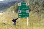
The closest I got to the Dempster highway was the sign in the picture attached ! We were headed south at that point and didn't have the time, but I was looking longingly at the map and that road to the arctic ocean. That was 2006 and an opportunity hasn't come up since to get up there. Your pictures are an inspiration though.
 

Attachments

  • 012_9A.JPG
    012_9A.JPG
    192.7 KB · Views: 3
Hey @boogielander , random question, approximately how many miles have you put on your truck for the entire trip combined from your house to the point your at now?
And how many do you think you will have drove by the time you return home?
 

Users who are viewing this thread

  • Members online

    Back
    Top