5thGenRams Forums

Register a free account today to become a member! Once signed in, you'll be able to participate on this site by adding your own topics and posts, as well as connect with other members through your own private inbox!

Boogielander Build

Day 19 - Arctic Circle!
View attachment 188491
Today we crossed Arctic Circle and camped there.
But let's not get ahead of ourselves.

Knowing the harsh conditions of Dalton, I was mentally prepared for it, thinking if the semis can run on it, how hard could it be? Turned out, boy oh boy, I couldn't be more wrong.
My first wakeup call was on the highway leading to Dalton. The crew were regrading the foundation to repave the surface, and dumped a lot of sand and soil. When dry, that wouldn't be an issue, but it turned into a giant mud pit when wet. I had issues with traction and keeping the truck heading straight, and was fighting for traction in 2wd. Situation got better when I threw in 4H, but still was sliding around. The whole section was no more than 1000yard, but it felt like eternity. I was praying so hard to not get stuck or go sideways, because that would be really embarrassing.

I safely passed that section without getting bogged down, and got on Dalton.
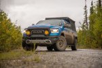
View attachment 188486View attachment 188485It was around 45F outside, with rain dripping down. Knowing if I didn't air down, the next ~800 miles would be bad for me, so I braved the windchill and aired down before getting on my way.
View attachment 188487
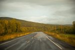
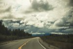
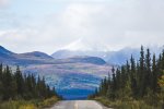
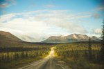
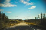
The beginning was decent and I kept my pace. The road was well graded without major potholes, but the rain made it muddy and slippery at some sections. However, it got bad after Finger Mountain at mile marker 96. Potholes that are wider than the truck's track width, potholes that are larger than the contact patch of my 35s, and potholes that are so deep that it can break suspension are scattered everywhere on the trail. Even worse, there are pothole gardens that I couldn't find a safe line to swerve around the potholes.View attachment 188488
View attachment 188489
View attachment 188490
I caught up to the vehicles in the front, and used them as markers to see which line to take.
The tire tracks on the trail are also good indicators of a safe line.
Then, the road got even worse. Fields after fields of potholes that no speed could make it feel better.
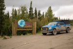
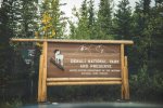
After what felt like an eternity, I finally arrived at the Arctic Circle Sign, my first stop for the day.
View attachment 188491
It was 5PM already, and I only covered about 113 miles. My original planned stop was at Wiseman, another 76 miles away.
The potholes drove the energy out of me, and I was done for the day. The coldness and the rain didn't help either.
So I called it for the day.
View attachment 188492
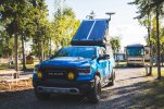
There's a campsite right behind the Arctic Circle Sign, so I claimed a site for myself.

I sat in my driver seat after positioning the truck, a first since I left home on 8/4, 19 days ago. I was tired, sore, cold, hungry, and wet.
The rain was still pouring, and I was in bear country so I didn't want to cook to risk attracting bears to come hangout near me at night. So, I had some jerky and some chips, and drank a can of coke for dinner.
Not the type of dinner I wanted after the last 20 miles of bumping around on fields of potholes.

View attachment 188494
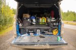
The mud caked on the truck was even worse to deal with than potholes.
These are the sticky type of mud. The mud that will not come off easily. My reverse camera was completely blocked, and the latch covers were stuck shut.
Good thing I put on those covers before leaving.

I setup camp, turned on my heater, started the Starlink, checked weather forecast, and have a decision to make: Extremely high possibility of snow (and resulting ice) on Atigun Pass is in the forecast. Do I take my chance with that 3000ft elevation and steep hills betting on I won't get stuck or slide off the pass just to say I did it, OR, do I play it safe, get to Coldfoot, and turn around?
View attachment 188495
By 9PM, the sun came out. I checked weather again. All sources indicated that weather would not be on my side further north.
As I refill the diesel in my heater, I walked around the truck, and asked if it wanted to keep braving the potholes.

By bed time, both of us agreed that we were done. We will save the Arctic Ocean for Dempster, where we will actually see the ocean instead of having to pay $80 for a shuttle bus to get to the ocean in Deadhorse.


As I am typing this up back in Fairbanks, part of me regret admitting defeat after driving this far for it. But that's just a small part of me. I thought of all the crashed and abandoned vehicles on the side of the road since I got in Canada, those are great reminders of why I shouldn't let my ego get in my decision making.

Afterall, I'm only almost half way done.

I smell a book in the making.....
 
Maybe a pressure washer to knock some of that mud off before you park for the night. It's one thing to park a muddy vehicle and walk away but when it's your home for the night, you know you're gonna contact that mud over and over again.
oh i was going to but decided to **** it. It's gonna get muddy the very next day anyways.
 
When you finish this epic trip it would be interesting for you to double back and discuss what you like, dislike and would do differently with the truck. Given that some of the components and mods were expensive, were they absolutely necessary? Or, perhaps you didn't go far enough and felt like you needed more robust suspension and larger tires. How about the electrical mods, the RTT, etc.?
oh yeah. i'm taking a 0 day today so I can do some of that now. then do another one after Dempster. then do a summary at the end when i get home.
one goal of this trip is to see what works, what doesn't, what's worth the money, and what's not.
i think comparisons of how I think before, during, and after will be good summaries and help others be better informed!
 
Day 20 - Admitting Defeat
Even though I've decided to turn around at Coldfoot, the whole day I've been second guessing myself with that decision because the weather's letting up.
IMG_8104.jpg
I packed up at 10AM, and what a mess this is.
IMG_8112.jpg
Stopped by Arctic Circle sign again, because I wasn't really pleased with the pictures from previous day.
Having redone the pictures, I headed north to Coldfoot.
IMG_8151.jpg
First stop, Arctic Interagency Visitor Center. This is the visitor center for all the national parks in northern Alaska that are not reachable by vehicle. Knowing I probably will not visit those parks due to the logistics involved, I stamped all 3 of them on my NP Passport. Here, I also bought some souvenirs: some patches, a Dalton Highway T-shirt, and my new travel companion: a grizzly bear stuffed animal. They have foxes, caribou, and moose, and all of them are so cute. But, I don't have enough money to get all of them.
Then, I fueled up in Coldfoot. Gas was whopping $7.99/gal here, and they only have 87 and diesel. I was sitting at half tank, and knowing I was turning around, I only put 10 gallons in. Enough to make it back to town, I thought to myself.
IMG_8152.jpg
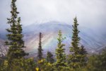
Leaving Coldfoot, I saw this. A rainbow right in front of me. The end of rainbow seems close enough, so I went looking for my pot of gold.
Unfortunately, the end of rainbow was in a controlled area: the airport and state trooper HQ. Maybe the pot of gold I was looking for was the adventure all along!
With lodging setup for the night, I took my time and spent some time taking pictures on the way.
IMG_8168.jpg
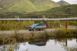
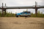
These pipelines look a smaller than they are. They are HUGE in person.
Seeing these in person made me appreciate the oil workers more. They are the people who keep this country going, braving the extreme cold in winter. 'MERICA!
IMG_8186.jpg
Found a random side road and took advantage.
Cloudy days are not ideal, but definitely better than full sun at early afternoon.
IMG_8232.jpgBefore long, I was at Yukon River again. This is the only place where you can get close to the pipeline with no gate.
IMG_8256.jpg
As I crossed over the last mountain pass and headed toward Fairbanks at 8PM, the sun came out. What a difference a mountain pass can make.
IMG_8260.jpg
I was greeted with this. A welcoming sight to see. IMG_8261.jpg

Goodbye, Dalton Highway.
Goodbye, Arctic Coldfoot.
Goodbye, Arctic Circle, until we meet again in Canada.

I got to my hotel at 930PM. Then it hit me... I am nearing the end of my Alaskan portion. Day 21 will be a 0 day where I stay in and relax, but I'll be crossing the border in 4 days.
Alaska has been good to me. I almost don't want to leave.
 
And of course, Boogielander Cafe shot


And then we arrived at Independence Mine

They say only 30% of the visitors to Denali get to see the mountain.
WELL DONE ! We numbered ourselves among the 70% our our trip up there :-( Mountain was out there somewhere but we never saw it.
I remember Independence Mine. It's not too far from Wasilla, you probably passed through or near Wasilla. It's a ho-hum sub-urban sprawl town, feels just like any other American suburbia...apart from the views which are stunning on a clear day.
My wife's brother lives there. He joined the airforce out of school, worked his way up to being a Chief Mechanic on the F15 jet. I understand he would have had his name on the plane he maintained. Did a few tours of duty ( including Iraq I think ), and finished up in Alaska. He loved it there and when he got out of the AirForce he settled here. Lives in Wasilla and works in a Ford dealership these days ( sorry for mentioning a bad word on a RAM forum !) He's a transmission specialist I believe, works in the shop on the complicated stuff. He has little respect for the majority of the techs that work there, says he'd never recommend anyone bring their vehicle to a dealer for service :) . anyways, in the unlikely event you need a decent mechanic ( knock on wood you do not ! ), I have a contact up there who's pretty solid. Based on your itinerary you won't be back that way I don't think though. Are you going across "top of the world highway" to Dawson city ultimately ?
 
Well done on getting to Artic Circle and Coldfoot. I think you made a wise choice given the weather and going solo. I looked at my pics - we did a bus tour up to Coldfoot. What a difference a dry road makes, we had dry and dusty. Potholes, yes, but no mud. The tour bus ( a smaller mini bus ), went about 25mph most of the way, boy was it tedious. But, we got pics at the article circle, lunch at Coldfoot and we got to learn about the Pipeline from the driver. Did you notice those circular things like radiator fins on top of the posts ? They put those there, we were told, to disperse any heat getting into the metal support structure because they really really don't want to soften the permafrost the pylons are bedded into. That could be bad. The engineering of that thing is just incredible. Like you, I salute the workers who work up there year round.
This might give you a laugh : the TFL Truck you tube channel did a thing a couple years ago where they drove an F150 Lightning clear up to Deadhorse. Along the way they passed this particular wreck in the ditch off the highway. It may have been there a while. But. someone had put a "For Sale" on it, and written on the sign " No low-ball offers" 🤣
 
WELL DONE ! We numbered ourselves among the 70% our our trip up there :-( Mountain was out there somewhere but we never saw it.
I remember Independence Mine. It's not too far from Wasilla, you probably passed through or near Wasilla. It's a ho-hum sub-urban sprawl town, feels just like any other American suburbia...apart from the views which are stunning on a clear day.
My wife's brother lives there. He joined the airforce out of school, worked his way up to being a Chief Mechanic on the F15 jet. I understand he would have had his name on the plane he maintained. Did a few tours of duty ( including Iraq I think ), and finished up in Alaska. He loved it there and when he got out of the AirForce he settled here. Lives in Wasilla and works in a Ford dealership these days ( sorry for mentioning a bad word on a RAM forum !) He's a transmission specialist I believe, works in the shop on the complicated stuff. He has little respect for the majority of the techs that work there, says he'd never recommend anyone bring their vehicle to a dealer for service :) . anyways, in the unlikely event you need a decent mechanic ( knock on wood you do not ! ), I have a contact up there who's pretty solid. Based on your itinerary you won't be back that way I don't think though. Are you going across "top of the world highway" to Dawson city ultimately ?
can always try again to be part of the 30%! wait... if you were in the 70% and then become part of the 30% then what does that make you :unsure: my math is no good LOL
I can see why he chose to end up in Alaska. This is a magical place. I'd stay here if it wasn't for the cold winter and lack of authentic Asian food (most places are just "good enough when on a road trip" for someone who grew up in Asia for 18 years lol) i'm not going down that way. a rec would be helpful for Anchorage because I crossed my 5k miles mark there after my previous oil change lol I ended up finding a shop with decent reviews to have them do a drain and fill. I was going to go see an outfitter while in Anchorage and potentially see how it is working there, but didn't have time LOL

I am crossing via Top of The World in 4 days to get to Dawson City and do Dempster. It's bumming me out that I am leaving AK in 4 days already. I like Fairbanks more than Anchorage for some reason.
 
Well done on getting to Artic Circle and Coldfoot. I think you made a wise choice given the weather and going solo. I looked at my pics - we did a bus tour up to Coldfoot. What a difference a dry road makes, we had dry and dusty. Potholes, yes, but no mud. The tour bus ( a smaller mini bus ), went about 25mph most of the way, boy was it tedious. But, we got pics at the article circle, lunch at Coldfoot and we got to learn about the Pipeline from the driver. Did you notice those circular things like radiator fins on top of the posts ? They put those there, we were told, to disperse any heat getting into the metal support structure because they really really don't want to soften the permafrost the pylons are bedded into. That could be bad. The engineering of that thing is just incredible. Like you, I salute the workers who work up there year round.
This might give you a laugh : the TFL Truck you tube channel did a thing a couple years ago where they drove an F150 Lightning clear up to Deadhorse. Along the way they passed this particular wreck in the ditch off the highway. It may have been there a while. But. someone had put a "For Sale" on it, and written on the sign " No low-ball offers" 🤣
oh yeah if it was dry i'd be in deadhorse tonight according to my original route plan.
i can deal with the potholes, but not the mud... the mud was so thick and sticky that it actually "sanded" off the Steel It paint on my slider, and took out some decals on the driver side. I can't deal with 25MPH lol my minimum is 35-40 even when crossing fields of smaller potholes. The big ones are the ones that i slowed down to swerve around or just embrace for impact. I got to Coldfoot past 1PM, and decided to try to get back to Fairbanks while I still have dinner options. That plan fell apart quickly LOL

I was wondering what those fin-like things were! Thanks for explaining! There were quite a few wrecks on the route... great reminders for not F around to find out lol
 
Day 22 - Denali Highway
Day 21 was spent doing nothing in Fairbanks other than to wash the mud off my truck. I like Fairbanks more than Anchorage for some reason... probably because it's a way smaller town and the Asian foods are more authentic (and more expensive)

Anyways, we left Fairbanks behind and headed south.
IMG_8280.jpg
Clouds hanging really low for some reason. I noticed the clouds sit lower up north than in lower 48.
IMG_8294.jpg
As I continued down Parks Highway, I passed by Denali again. I tried to position the truck to be next to the sign, but couldn't do it. There's a post at exactly where the truck would be.
IMG_8330.jpg
Denali Highway is an unpaved highway, the OG route to get to Denali from Anchorage before Parks Highway (the current route) was constructed. I aired down at the end of pavement, but in retrospect, I don't think airing down was needed.
I looked around while airing down, and found this perfect opportunity to take the picture I've been trying to take.
IMG_8333.jpg
Then, off I went. Boogie all the way, only slowing down to let vehicles pass or passing vehicles.
I was stuck behind two sprinter vans until they found a good spot to let me pass. I signaled them and then gunned it. They were doing 35 when speed limit was 50.
IMG_8336.jpg
As I continued, I saw a rainbow to my left. I found a clearing in the trees and pulled over to capture it.
After that, I kept going, and stumbled upon 2 cyclists. I waited, until one of them signaled that I should pass them. As I passed them, I slowed down to slightly faster than their pace. when I checked my mirror to see if I cleared them, I noticed one of them was missing. Then, I found him: dude was drafting behind me. I let him do some more of that then slowly increase my speed to pull away.
I got places to be man!
IMG_8468.jpg
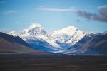
The first half of Denali Highway follows the ridge that gives a good view of Hess Mountain, and there are plenty of good sites. I found this random pullout that offers good view of the snowcapped mountain, so camera and big lens time.
IMG_8470.jpg
I would camped at this site, but the site that I've picked is much better and less windy.
IMG_8513.jpg
By 5PM, I got to the site that I chose.
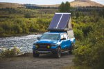
I got the whole place to myself, while a couple setup on the other side of the river a bit more upstream. Their site was next to the primary spot that I wanted, and when I asked if I could setup at a site 50ft from them, the male said it's a bit too close.
Like dude, you got the entire beach to yourself, I am just off to the side and behind a bush. He even said 120 miles to choose from man and look offended. I said ok and moved on to the other side of the bridge and found this spot.

I get it, he doesn't want people to be close to him. That's fine, but no need to bring that attitude.

People can be real ******-bags sometimes!
 
Day 23 - Last Night in Alaska
I made another last minute decision to skip one more camping spot, simply because it's way too close to the one I had on Denali Highway... like, just 2 hours away. So, I decided to not camp there, and head to Tok and spend the night there instead since I spent my first night in Tok it'd be fitting to spend my last night there.
IMG_8533.jpg
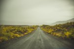
Woke up to rain and fog on Denali Highway, but the fall colors were here.
IMG_8560.jpg
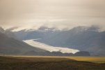
Spotted my 6th (or 7th) glacier of the trip. There's a trail leading to near the glacier but doesn't land me at the glacier, so I didn't even attempt.
IMG_8600.jpg
Then, I found a pull out that overlooks the valley I just came from. The snow capped mountain range and the yellow-green vegetation in the valley serve as signs of fall's arrival.
IMG_8656.jpg
Denali Highway was completed before I knew it. I aired up, and headed toward my next stop (and my originally planned campsite): Gulkana Glacier.
The beginning of this trail was easy, for about 5 minutes. There were plenty of watercrossings from the melting glacier and rain, so I took those opportunities to "wash" off the frame and underside. Not sure how that turned out lol
When I got to the trailhead parking lot, there's no one and the hike in was a long. Having spoiled by the glacier at Kennecott, I decided to turn around and try to get to the next spot: the Ice Cave.

Perhaps I was too busy admiring the views and wasn't paying attention to the map, I missed the ice cave trailhead parking lot. As in, I did not see it at all: no sign or anything. Well, not really a big L, because the ice cave in summer is melting and the pictures wouldn't come out right anyways. Winter would be the right time to go.

IMG_8696.jpg
As I pressed north, I noticed more peaks got snow on them. They call these "termination dust" which signals the end of summer and arrival of fall and soon, winter.
IMG_8778.jpg
Before long, I drove out of cloud zone and got back under the sun. I am so thankful that I borrowed my friend's telephoto lens. Can't get these kind of shots with my 35-70mm lens. To be honest, I am even thinking about buying it from him since he doesn't use it anymore.
IMG_8813.jpg
Having spent enough time poking around taking pictures at multiple random pull outs, it was time to head north again.
I filled up the tank at Delta Junction, then back on the Alcan. This time, heading east.
As I soaked in the view and enjoyed the sunshine, I spent some time to look back at my 2 weeks in Alaska.
Alaska had been good to me. I climbed a glacier for the first time in my life. I had wild caught salmon, wild caught cod, halibut, and scallops straight from the port for the first time in my life. I also visited a ghost town and actually got into the milling building for the first time and have a deeper understanding on how mining works, which kind of resonated my family's history - my grandfather owned a coal mine in Taiwan way long ago, and I never got a chance to see it myself. I visited Whittier and Seward, saw bears and had a close encounter with one at the Buckner Building. I visited Buckner Building, and saw the "town in one building" Whittier. I spent one full day in Anchorage, getting to know the city by experiencing it than seeing it on the map. I also saw Independence Mine and learned about the history, then went down Hatcher Pass and decided that Colorado Alpine was better. I saw Denali on my first attempt, placing me in the 30% club. Spent some time in Fairbanks, visited North Pole, and fell in love with Fairbanks. I also headed up Dalton Highway, got to Arctic Circle, got Coldfoot, and turned around. Then I did Denali Highway, the OG way of getting to/ from Denali.
Saw numerous glaciers in 2 weeks, and be on one.
As I drove, I really had the urge to turn around to go back to Fairbanks, then head up Dalton again. I didn't want to leave it unfinished., even if that meant I had to brave the icy road surface. But the logical and practical side of Taurus got the best of me: it's not logical and practical to do it. I still got Dempster and many others on the Canadian side to do, and reattempting Dalton would shave off 4 more days and put my plan in Canada in jeopardy.

As I neared Tok, I am already looking forward to the next time I come back. Only, next time, I will ship my truck over and hopefully, with a Power Wagon or even an Expedition Truck (so I have less incentive to take cheat days)

IMG_8832.jpg
Home for the night. Paid for a electricity and water site but ended up not hooking up Starlink to the outlet lol
IMG_8834.jpg
What better way to celebrate the last night in Alaska than this?
IMG_8835.jpg
Dinner served with a side of Yellowstone. After dinner, while there was still light out, I had a cigar.

What a great way to end the Alaskan leg of the trip.

Alaska, you've been great. Till next time!
 
Only, next time, I will ship my truck over and hopefully, with a Power Wagon or even an Expedition Truck (so I have less incentive to take cheat days)
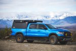
Could you expound on this statement? What do you find deficient with your current setup?
 

Users who are viewing this thread

Back
Top