5thGenRams Forums

Register a free account today to become a member! Once signed in, you'll be able to participate on this site by adding your own topics and posts, as well as connect with other members through your own private inbox!

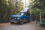
Boogielander Build

Thank for all the posts!! I'm guessing you didn't get Hyderized? ... things you learn from google....
1723587713481.png
 
What a great trip and some amazing pics and memories.

FYI, You drove through my home town of Williams Lake, BC. I moved away in 2001 but I recognize many of the spots where you stopped for pics.
 
Wow, these have got to be some of the best, most beautiful, most bad *** RAM pictures ive seen, seriously. This is awesome. Glad you could share your journey with us man! Be safe!
 
Man what an awesome trip!!!! Keep up the uploads I’m loving it!
im running one day behind on all the posts lol
CG hosts love to put me at sites with tall trees blocking my starlink. and im also starting to think starlink has less satellites above 60degree North... because in the lower 48 i had no issues with connectivity even with tall trees.
 
What a great trip and some amazing pics and memories.

FYI, You drove through my home town of Williams Lake, BC. I moved away in 2001 but I recognize many of the spots where you stopped for pics.
wow that's a long time ago!
it's a nice little town. being from a city i like smaller towns.
 
So awesome! And as awesome as these photos are, I can't imagine how much more breathtaking the scenery is there in person. Enjoy it man! Keep us along for the journey!
thanks!
i'm enjoying it but the long driving days are kicking my *** lol
i should've left a month early so i don't have to get through everything before 9/15 when 90% of the places are closed for the year.
 
Very nice trip, I envy you. The glaciers are magnificent. When you stand on one the ice can be a pure blue color and you are looking at water thats been frozen a long, long time.
 
Very nice trip, I envy you. The glaciers are magnificent. When you stand on one the ice can be a pure blue color and you are looking at water thats been frozen a long, long time.

yes! that's actually the activity for tomorrow.
i hope i get to see glacier pool!
 
Day 9 - Crossed 60 Degree North
We crossed 60 Degree North today, saying goodbye to British Columbia and hello to Yukon.

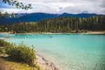
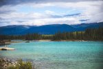
But before we did that, we visited Boya Lake
IMG_6523.jpg
I'm not sure if this counts as an alpine lake, but the water is so clear and blue.
So beautiful. But a bit too windy.
IMG_6574.jpg
The sun was out, so the fish were hiding in the shadows under the floating pier.
IMG_6575.jpg
People were enjoying their day out. I wish I had a kayak so I can spend a day or two here.
The sites were clean, and free firewood were provided but due to fire ban in the entire BC, no camp fire.

Spent a good hour at the lake, just relaxing and soaking in the views, then I had to go. I got a long day of driving before me.
IMG_6589.jpg
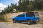
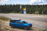
Then, we reached the Yukon/ BC border. This also meant that I was officially crossing over 60 Degree North, and the end of first leg of the trip: Cassiar Highway.
(sorry for the pic quality... I had to resize the pics so the forum server will accept it)
IMG_6593.jpg
We said bye to BC for now. Thank you BC for 5 days of beautiful views, friendly people, and unforgettable memories.

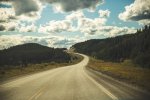
Soon after we hopped on the world famous Alcan.
IMG_6608.jpg
Not sure if it was me or something, but the sunlight over 60D North hits different. Temperature dropped slightly too.
Lots of up hills that I had to fight through, so my mileage suffered slightly.
IMG_6611.jpg
IMG_6636.jpg
And there were more sections of gravel roads and constructions. But maybe because of the time I picked to go through, a lot of construction zones were not active.
IMG_6641.jpg
Picked up more bugs and stuff on the grille... I have at least 6 dead dragon flies and countless bees on my front end.
After that quick stop to see the bridge before crossing it (and use the restroom... sorry, washroom), off we went.
Finally, right before dinner time, we arrived at camp in Whitehorse.
IMG_6657.jpg
I had my second paid meal in Canada at Whitehorse: Ramen at a restaurant owned by Chinese.
I ordered in Chinese and maybe because I spoke the language the people hooked me up. The bowl was filled to the rim!
$25CAD well spent.

One thing I learned was tall trees do block Starlink beyond 60Degree N... My site had some tall trees behind, and that somehow made my Starlink performance suffer. Connection dropped every 7 minutes and then spend another 5 minutes trying to go back online.
These were nonissues before crossing 60Degree N. Hell, I had my Starlink setup in a forest when in lower 48 and it still worked great. That's why nothing was updated that day.
 
Day 10 - BIG DAY
Today was the BIG DAY for both my truck and I. But let's retrace our steps.

I took a late start today, because I spent some time in Whitehorse doing shopping (because day 11 and 12 will be "base camp mode" and there's nowhere to stock up) and exploring the town.

Then, I hopped on the last stretch of Alcan at 11AM, just as the rainstorm started to move in.
IMG_6690.jpgIMG_6694.jpg
Snow capped mountain in the distance after passing Haines Junction. I would totally go to Haines if I had time, but unfortunately there's not really time for me to do that.

Before long, we arrived at Kluane Lake, the biggest lake in Yukon. I hopped out to get some pictures and videos, but the wind was so strong and the temperature was so low that I couldn't handle it to explore more.
IMG_6711.jpg
Then we stopped at the visitor center to learn about the area and the people.
IMG_6719.jpg
IMG_6721.jpg
Apparently, there was "high sheep activities" in that area, per the LED sign, but I didn't see anything. I guess it was too windy and too cold for the sheep to come out and play.
IMG_6732.jpg
Then we stopped to look at Kluane Lake for a second time, before we got on Alcan again.

I knew Alcan was rough, and plenty of people broke their rigs and trailers driving it. BUT, since I have a purpose built truck that can handle higher speed in the desert, it makes me wonder how bad it actually was.
IMG_6748.jpg
Overall, it was okay for likes like Boogielander.
Yes, there are sections with gravel, big potholes, big dips, frost heaves (or as us desert people call it, whoops). But I maintained my speed at speed limit the entire time, even through the "rough sections"
At 40PSI, front suspension at on-road setting, the truck performed really well. The driver though, was overly concentrated on finding the perfect line to avoid overly large potholes that can further damage the road surface.
The whole trip took 6 hours to get to the border, but that section felt like I was driving for 12 hours.
IMG_6781.jpg
 
Day 10 - BIG DAY cont'd
Finally, we arrived at this:
IMG_6806.jpg
The ALASKA sign. We've made it!
Crossing the border took less than 30 seconds. The agent asked me if I had any commercial goods, alcohol, tobacco, or anything I need to declare. I told him no sir, nothing to declare. He then asked me where my truck is plated. After that, he scanned my passport, and said this:
"Welcome home, sir!"
HOLY F*CK! That simple line gave me goosebumps and almost brought tears to my eyes. After 5 days in Canada dealing with KMPH and felt like a foreigner not knowing anything, the "Welcome home" was a god-send.
I was so glad to switch my units back to MPH and miles, and Fahrenheit.

IMG_6808.jpg
After getting into Alaska, the sun came out.
IMG_6821.jpg
Road got a lot better, after the rough boogie section I had.
I made it to Tok right before 7PM, managed to slip in the last order at this Thai place in Tok right before kitchen close.
IMG_6824.jpg
And brought it back to camp to eat.
IMG_6823.jpg

Once again, I was put at a site with tall trees, so... Starlink dropped every 7 minutes.
 
@boogielander Enjoying the virtual ride along, and hoping to make the trip someday myself. Curious if you've fired up the amateur radio on the trip.
Glad you're here! Spiritually here!
I am logging the entire route by day so if you need them in the future let me know!

I fired it up here and there to get NOAA weather reports lol
I got no one to talk to and I didn't set it up to hit repeaters. Kinda want to pick up a CB at Anchorage so I can communicate with the truckers on Dalton. hmm...
 
Day 11 - Getting my first NPS Passport Stamp and Boogie Time!

I recently (meaning, June) picked up a NPS Passport book to collect national park stamps as token of "I WAS THERE"
Never thought about it until before leaving for the trip, so I ordered one.
Today's itinerary was simple: leave Tok and get to Wrangel St. Elias National Park, then drive into McCarthy.
IMG_6829.jpg
Beautiful day for a nice drive... until the frost heaves took over.
I had enough of this so I hopped out, changed my front suspension settings to offroad mode, and it was perfecto *chef's kiss*
IMG_6840.jpg
Mount Drum and Sanford in the background.
IMG_6847.jpg
Obligatory tourist picture.
IMG_6852.jpg
Having collected my stamp and bought nothing from the visitor's center, I kept trucking.
Going down this road was fun and I enjoyed it, until I realized I gotta do this in reverse on Friday. oh f*ck...

After endless construction zones, it's finally time to boogie.
IMG_6859.jpg
I was on the fence about dropping tire pressure, but a few bumps early on helped me make my mind really quick. Dropped to 30 PSI and off I went.
IMG_6869.jpg
Road was overly decent, but some sections were rough with potholes and stuff. Having no lead truck, I had to keep my eyes on the horizon and slow down for blind corners. You can tell who's the tourist and who has dirt road experiences: tourists in their rentals don't turn on their headlights, and never slowed down when approaching. Frigging a-holes.
I ran my S2 chase lights the whole trip, because of how big of a cloud of dust I was making. I also stopped for ADV bikers to pass me when they approach as well. I also managed to pass a RV and a RAV4 on the way in too. They saw my LP9s and knew I meant business, I guess.

The whole trail was around 60 miles long. Took me less than an hour to complete aside from sitting and waiting at traffic control zone. The RV and RAV4 that I passed didn't arrive until I finished cooking dinner and setting up camp lol

IMG_6874.jpg
This is the basecamp for tonight and tomorrow night.
IMG_6879.jpg
I will be hiking the glacier tomorrow. IMG_6883.jpg
And also visit Kennecott Mining Town after.
IMG_6886.jpgWhat a sight!

Side note:
This is why I did boogielander build. The trail can be done with a Camry or a Subaru (as RVs made it in), but the difference is, how comfortable do you want that 120 miles (round trip) to be?
Doing 35MPH dodging potholes and such, or, doing 55mph and go over everything like they're not there, while being overpacked?
Boogielander build at its current form is about $100k, including the truck. So far, 11 days in, the truck and the whole camping experience has been flawless (aside from Starlink not performing above 60D North when there are tall trees around). I get to spend more time at places, send it through trails, and still get to camp early enough to snag a good site while other people gotta spend less time at places, go slow on the trails, and still get to camp later and not get a spot as good.
11 days in, my build philosophy is proving itself!
 
Last edited:
I'd love to see pics of Kennecott mine. It's history is detailed on the TV Series "Edge of Alaska".

That is some beautiful country up there. Are you going to brave the "Top of the World" highway from Tok to Dawson City?
We did the "Trek over the top" on snowmobiles back in 2005. That's over 200 miles each way on snowmobiles. You pass by old mining dredges and some amazing back country that are right up your alley. I'm not sure how passable that road is these days but that stretch alone would be worth making the trip up there.

For the trip back, there's a hot spring South of Tok that's not too far out of the way. We found it on our way home but it was cold, snowing and late so we just took some pics and hit the road again.
IMG_0297.JPG
 

Attachments

  • IMG_0259.JPG
    IMG_0259.JPG
    138.5 KB · Views: 16
  • Trekkers05 112.jpg
    Trekkers05 112.jpg
    192 KB · Views: 17
  • Trekkers05 153.jpg
    Trekkers05 153.jpg
    141.8 KB · Views: 16
  • Trekkers05 122.jpg
    Trekkers05 122.jpg
    114.3 KB · Views: 16
  • Trekkers05 033.jpg
    Trekkers05 033.jpg
    150.3 KB · Views: 17
  • IMG_0245.JPG
    IMG_0245.JPG
    81.5 KB · Views: 18
  • IM002357.JPG
    IM002357.JPG
    157.1 KB · Views: 17
Glad you're here! Spiritually here!
I am logging the entire route by day so if you need them in the future let me know!

I fired it up here and there to get NOAA weather reports lol
I got no one to talk to and I didn't set it up to hit repeaters. Kinda want to pick up a CB at Anchorage so I can communicate with the truckers on Dalton. hmm...
I will have to grab an archive of the thread after you've come back, especially the good Thai and Vietnamese eats along the way.
The NOAA weather reports are great to listen to, my radio even will respond to their emergency alerts as I discovered when I was in Texas for the eclipse).
Repeaters do take a lot of time to research and program in. I've easily spent a couple evenings when I've done it for some of the road trips I've taken. Can be fun to break up some of the monotonous driving through. Doesn't seem like a whole lot of '52 activity outside of socal though. Haven't run CB in years, but the couple times I've tuned around at home, there hasn't been too much to listen too. I stopped running CB when the modern electronics laden Trucks/Cars made it too ridiculous to hear much. Might have some luck with other HF bands... I've run into a couple truckers on 40m. Western Washington and Canada seem to do pretty well back into SoCal in the evenings.
Hopefully you get to enjoy some good N lights shows while you're there.
for sure!
i listen to NOAA weather just in case my inreach doesn't get the weather alert (i signed up for a weather alert system that sends alert via inreach mini2). so far nothing too concerning just yet.
i thought about CB because it seems like that's what those truckers run on Dalton (at least, that's what i heard). but so far 13 days in I've yet to find a reason to communicate with the truckers on the road lol
 
I'd love to see pics of Kennecott mine. It's history is detailed on the TV Series "Edge of Alaska".

That is some beautiful country up there. Are you going to brave the "Top of the World" highway from Tok to Dawson City?
We did the "Trek over the top" on snowmobiles back in 2005. That's over 200 miles each way on snowmobiles. You pass by old mining dredges and some amazing back country that are right up your alley. I'm not sure how passable that road is these days but that stretch alone would be worth making the trip up there.

For the trip back, there's a hot spring South of Tok that's not too far out of the way. We found it on our way home but it was cold, snowing and late so we just took some pics and hit the road again.
View attachment 188077

i am actually doing Top of the World after Dalton.
It will be Dalton, Denali Highway, through Tok (not staying, maybe), Taylor to Chicken then TOTW to Dawson City, then Dempster.

Do you remember where those two mining things were?
 

Users who are viewing this thread

Members online

Back
Top