5thGenRams Forums

Register a free account today to become a member! Once signed in, you'll be able to participate on this site by adding your own topics and posts, as well as connect with other members through your own private inbox!

Boogielander Build

boogielander

Spends too much time on here
Joined
Jun 29, 2022
Messages
2,140
Reaction score
3,265
Day 12 - MOM! I'M ON A GLACIER!
One thing I wanted to do when I started planning this trip was to climb a glacier. Glaciers are shrinking, no doubt, so I want to take advantage of that before I have to hike further in to get to them.
That's one of the reasons why I came out to McCarthy and Kennecott (in addition to driving McCarthy Road). Root Glacier is the one that checks off both items off the list.

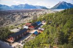
So... I woke up at 7AM to get ready for the guided hike. The first 2 miles or so was through Kennecott Milling Site and through forest. We were trying to get ahead of everyone else, so we hiked really fast (by my standard)
Finally, we arrived.
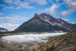
IMG_6909.jpg
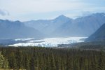
Still distance away from the glacier. We had to go all the way down to the bottom of the "canyon."

We then put on our crampons at where the ice meets the rocks. And off we went.
The brown portion right at the beginning may seem like they're dirt, but they are actually ice underneath.
How does it feel? Crunchy. Like when you're chewing on a piece of cookie. With regular shoes, it is guaranteed that you will slip. But with crampons, the metal "claws" dig into the ice and give traction. Every step is accompanied by the "crunchy" sound. It was fun for the first few minutes, then I got used to it.
We hiked a mile or so in, before we saw this:
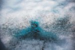
IMG_6939.jpg
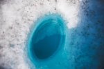
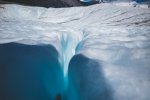
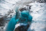
A small blue pool hidden underneath. This one was shallow and small. Can't jump.
So we hiked more. And found this.
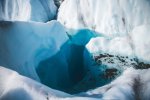
IMG_6956.jpg
This one's deep. So deep that we can't see the bottom. There's no way to get any closer. So, no jump.
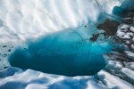
IMG_6967.jpg
This one's shallower, also no way to get down.
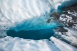
IMG_6970.jpg
We walked more, and it was lunch time.
We sat down on the glacier and had our lunch.
I looked around and found this
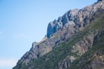
IMG_6977.jpg
Nested in the peaks is one of the mines of Kennecott. This one is Jumbo Mine.
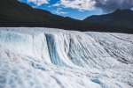
IMG_6990.jpg
I sat there and soaked in the view. It's hard to believe that 12 days ago I was still in the desert of Southern California and now I'm on the glacier.
That 4000 miles of driving was worth the trip.
Our guide said when Kennecott was operating, glacier was right next to the milling site. Now it's 2 miles in after ~100 years and continue to shrink. So in the future, people will need to hike further in to get to the glacier.
I'm glad I did it this time.
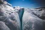
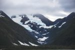
IMG_7000.jpg The blue hue of the glacier is only visible under shade or when it's cloudy out (other than the blue pool).
IMG_7020.jpg IMG_7030.jpg
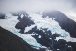
Close up of the glacier.
 

boogielander

Spends too much time on here
Joined
Jun 29, 2022
Messages
2,140
Reaction score
3,265
Day 12 - Cont'd
IMG_7045.jpg
Such a pretty blue
IMG_7048.jpg
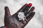
I picked up a piece of glacier (aka, ICE)
Before long, it was time to return to visit Kennecott.
IMG_7091.jpg
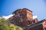
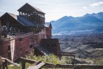
The whole building is sitting on top of the slope, and when the mill was operating, the whole building shakes.
It is still beyond me how they secure a vibrating building to the hill.
IMG_7096.jpg
NPS continues to restore the building.
IMG_7101.jpg
But some buildings are beyond repair.
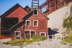
Pictured here: Left - the Clinic/ Hospital. Right rear: East Side Bunkhouse. Right front: female dorm and rec hall. They only had a handful of ladies working at a time: nurses, teachers, secretaries for upper management.
IMG_7137.jpg
IMG_7147.jpg
The "town" is free to visit to anyone who makes it out there, but going into the mill requires a tour. Only one company does that tour.
IMG_7148.jpg
Collapsing building.
IMG_7169.jpg
I learned that Kennecott was basically an on-going project its entire life. They add whatever is needed to the building, including one story inside the building because they realized they needed it a few years after milling began.
IMG_7192.jpg
The power station that supplies steam for the entire town. Everything ran on steam here.

The whole day was a 12 miles trip completed on my 2 legs. It was tiring, but it was well worth the trip.
I learned about the mining history, fulfilled my dream of climbing a glacier, and see the milling site from inside. There are still so many things to see, but my funding's not there to support it.

Do I recommend it? Yes, absolutely! Hell, I think for a better experience, I'd spend the money and get a private tour and stay in McCarthy or even at the Kennecott Glacier Lodge for the 100% full experience!
 

OCD Solutions

Well-Known Member
Joined
Nov 29, 2021
Messages
474
Reaction score
699
It will be Dalton, Denali Highway, through Tok (not staying, maybe), Taylor to Chicken then TOTW to Dawson City, then Dempster.

Do you remember where those two mining things were?
We spent 3 days in Dawson before riding back to Tok so I can't remember if they were on the way or if we saw them on one of our day excursions out of Dawson. IIRC, one was on the hwy between Chicken and Dawson and the other was just outside Dawson. I'll see if I can't get you some location details. But, that was back in 2005 so who knows what's left and where it might be now. For all we know one of those might be the one Tony Beets restored and put back in service a couple years ago.

Looks like the big one is called Dredge #4 and you need to book a tour out of Dawson.

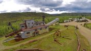
The little one is called the Pedro Dredge and its right beside the Chicken Gold Camp/Outpost.
The address is 1/4 mile, Airport Rd, Chicken, AK 99732.
One site says its open to the public 24/7 but a more recent one says there are limited tours available and to inquire at the Chicken Gold Camp.

Chicken has vastly improved since we were there in 2005.

Then...
IMG_0189.JPG

Vs now...

Chicken Alaska 2024.jpg
 
Last edited:

boogielander

Spends too much time on here
Joined
Jun 29, 2022
Messages
2,140
Reaction score
3,265
We spent 3 days in Dawson before riding back to Tok so I can't remember if they were on the way or if we saw them on one of our day excursions out of Dawson. IIRC, one was on the hwy between Chicken and Dawson and the other was just outside Dawson. I'll see if I can't get you some location details. But, that was back in 2005 so who knows what's left and where it might be now. For all we know one of those might be the one Tony Beets restored and put back in service a couple years ago.

Looks like the big one is called Dredge #4 and you need to book a tour out of Dawson.

The little one is called the Pedro Dredge and its right beside the Chicken Gold Camp/Outpost.
The address is 1/4 mile, Airport Rd, Chicken, AK 99732.
One site says its open to the public 24/7 but a more recent one says there are limited tours available and to inquire at the Chicken Gold Camp.

Chicken has vastly improved since we were there in 2005.

Then...
View attachment 188140

Vs now...

View attachment 188141
AHHH #4!
i saw that on google maps and was wondering if i should make a trip out... if it's tour only then probably will have to skip. im meeting my friends in Colorado in late September and i turn around Tuk on the 2nd. still have banff and jasper on the list to do lol
 

boogielander

Spends too much time on here
Joined
Jun 29, 2022
Messages
2,140
Reaction score
3,265
Day 13 - ANCHORAGE!!!
Day 13 was nothing but commuting from McCarthy to Anchorage.

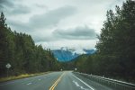
As per Boogielander fashion, I full sent out of McCarthy. Passed a whole bunch of cars and RVs on the way out, and left a big cloud of dust behind once I cleared them. That shaved 30 minutes off of ETA.
Then, I headed back up this long stretch of up hill.
IMG_7234.jpg

IMG_7253.jpg
Found a road side dirt patch to take a leak, then took a picture.
IMG_7261.jpg
More driving.
IMG_7282-Pano.jpg
Then, the view opened up.
IMG_7286.jpg
Obligatory side shot. Then I kept pushing.
Before long, I stumbled up on this place called "Glacierview"
IMG_7326.jpg
And glacier view it is!
IMG_7332.jpg
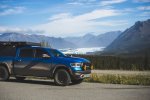
Of course, the truck needs to be in frame too.
IMG_7350.jpg
And the cold glacier water met the hot valley air, and fog happened.

I spent way too long at glacier view, so I had to pick up the pace once I passed Palmer. I got to my hotel in Anchorage just in time for dinner and turned in early for first bed in 10 days.
 

boogielander

Spends too much time on here
Joined
Jun 29, 2022
Messages
2,140
Reaction score
3,265
Day 14 - Most chill day of the trip so far

Today we left Anchorage and began our short trek down to Homer Spit, which was merely 3 hours away.
So, I took my time getting up from the comfortable bed, and had lunch at "the best pho in Anchorage" (it's not bad, but for sure not the flavor I'm used to)
IMG_7354.jpg
View from my driver seat outside of the hotel.
IMG_7366.jpg
First stretch of the highway was next to the beach. Found a pull off to soak in the view.
IMG_7369.jpg What a view it was!
IMG_7403.jpg
Then, I hopped back in the truck and drove toward my destination for the night: Home Spit.
My campsite for the night is situated right by the beach. There's no dispersed camping and campsites fill quickly, so I reserved this site 2 months before the trip.
The site I got was called Eagle Lady, named after Jean Keene who gained national attention for her feeding of wild bald eagles on the beach of Home Spit, and that was the exact site she always stayed at.
IMG_7434.jpg
Home for the night. Electrical only.
IMG_7436.jpg
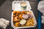
Dinner for the night: Seafood Sampler with fries. All the seafood were from the boats of the Spit, and the chowder was one of the best I've had.
IMG_7437.jpg
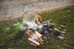
First camp fire for the trip.
I got in early at ~5PM, setup and get squared away, sat on the beach for a while to soak in the sound, smell, and scenery. Then, I went to pick up dinner, and had dinner sitting on my tailgate, watching my camp neighbor got married on the beach. Everyone who noticed were cheering for them.

After dinner, I started the fire, and sat by the fire to type up drafts for the blog posts for my site while smoking a cigar (Stuff I posted here are all summaries, due to 10 image restrictions. My site will have the more detailed trip reports). I did that for a good 3 hours before my other neighbor started showing off pictures of his son playing in the cold ocean and we talked about video games vs being in nature. I told him I experienced that and what he's doing is 100000% good for the kid, because I personally went through similar experience and that's why I'm out here.

I also got a fellow Rebel owner coming to say hi and asked me about my setup. Then another guy walked past and saw my solar setup and asked me about it.
Then, my neighbor from the next site locked themselves outside of their RV. The wife started sharing their trip experience with me, and we both agreed that it's been a disastrous trip for them: their tow vehicle and their motorhome flipped at Top of the World, and it costed them over $25k to get it recovered by a wrecker and brought over 200 miles down to the nearest repair place. Then they went on their dog-sledding tour, and the helicopter to pick them up couldn't fly up to the mountain to get them due to weather, so they had to stay up there for one night, which they weren't prepared for. And now they locked themselves out but a locksmith's coming to open the door for them.

The site's crowded and everyone's next to each other, so no privacy. But, everyone's friendly and like to share stories with each other. And plenty of people from different corners around the world too. It was a great spot and I want to return already.
 

boogielander

Spends too much time on here
Joined
Jun 29, 2022
Messages
2,140
Reaction score
3,265
Day 15 - Rain on my parade
Today was a fluid day for me. Made plenty of last minute decisions.
Woke up at 5 AM with strong gusts blowing at my tent from the wrong direction and rocking the camper every direction. Fearing damages to the camper, tent, and starlink I got up to turn the truck around (and probably woke up my camp neighbors while doing so) and stowed the dish. I went back to bed after.

Woke up at 10AM, packed up, and as soon as I left the Spit, rain started.

Originally, my plan today was to go to Seward and Whittier, then camp at Whittier. But with the rain forecast and strong wind, I decided to play it safe and made the last minute decision to go back to Anchorage for the night. Afterall, I do need a 0 day and also do oil change.
IMG_7442.jpg
While driving through Chugach State Park. Clouds were low, rain was coming down, but the truck handled like it's on rail.
IMG_7444.jpg
Seward was an overly touristy town for my taste so I got lunch and moved out. While eating lunch, I made the last minute adjustments to my hotel booking and booked the Whittier Tunnel pass.
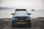
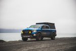
Then, I found this beach access/ boat ramp. Backed the truck in for some pictures.
Picture doesn't do justice, but my front end was filthy, even after the rain washed most of it away (kind of)
IMG_7455.jpg
There's only one road to get to end of the Seward, and it is through this cliff-side road that has posted "falling rock" warnings everywhere.
It is unpaved with no guardrail, so one simple mistake could mean going for a swim.

I was aiming for 530PM tunnel access, so I got out of Seward and drove to Whittier, which was an hour and half away.
I happened to get there just in time when they started to let cars go through from the inside. Good thing I made that, or else I'd be sitting around for at least 45 minutes for the next one.

Once I passed the tunnel (which is the only way in and out for anything land based for Whittier, including trains), I drove through the town. There's literally no tourist trap inside the town. It's mostly a transition hub for tourist on Alaska rail to get on cruise ships.

I drove through the town, and looked for end of the road. Pavement ended quickly, and became a graded dirt road.
IMG_7546.jpg

to be continued

side note: two lenses are used for this trip: my regular 35-70mm Sigma with polarized filter, and a 70-200mm Canon with a 1.4 extender with no filter. Sometimes I use the 1.4x extender, other times I don't.
 

boogielander

Spends too much time on here
Joined
Jun 29, 2022
Messages
2,140
Reaction score
3,265
Day 15 - BEARS!!! cont'd
After poking around the overlook at the end of the road, I started down to see the second reason I came to Whittier for (first reason was the tunnel).

I saw a road leading to the beach while I was leaving the overlook, so I went for it.
It lead to a small parking lot, with a few RVs parked there already. Looks like people were fishing in the stream that feeds into the ocean.

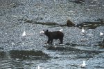
Then, I saw it. I couldn't believe what I saw, until the family nearby confirmed it. I told the family that's the first bear I've seen in my entire life, and the kid laughed and said "I've seen so many!"
Alright kiddo. No need to brag. Have you seen coyotes?
IMG_7592.jpg
The furry friend was eating dinner, while the birds were f*cking around. I guess they're not afraid to find out.
I then thought it was a cub and mama was somewhere around, but after a while I realized it's an adult. Black bears are smaller in size compared to grizzlies, or so I was told.
I snagged a bunch of pictures with my 200mm lens, and this time I regret not having a 400mm one. I stood on the viewing area over 200 ft away.

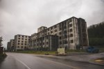
Having seen the bear enjoying his delicious salmon, I started to get hungry. So I got up and left to see Buckner Building.
IMG_7595.jpg
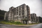
Buckner Building was build for the US Army when Whittier was still a military base. It was designed and build to serve the entire base, featuring barracks, offices, barber shop, theater, grocery store, bowling alley, rifle shooting range, garage, kitchen, dining hall, and everything else. It was build that way simply because it's too cold in winter.
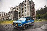
It was abandoned after the military pulled out of the area in 1966. With the windows and doors missing, the building started to degrade. Whittier city took possession of the building in 2016 and installed the fence along the exterior. I really wanted to go inside, but there's no way.
I also packed my drone with me, but couldn't send it up because of the rain and wind, and I was being eaten by mosquitos.
IMG_7620.jpg
So, I walked around, snagged some photos, and went back to the truck.
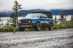
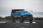
I really wanted a photo of the truck with the building, so I repositioned it.

I got out, walked over to take my picture, and then saw something in the corner of my eye. I turned around, and there was this guy.
IMG_7625.jpg
Buddy was hiding in the bush. I think that was a cub but I wasn't sure. Guy was around 50ft from me, well within its striking distance. I froze, looked at it, and backed up. Buddy was looking at me the whole time. Then, I turned around, snagged the picture I wanted, and hopped into the truck.
Guy ran away into the bush as I drove down the street toward it.

IMG_7626.jpg
Not the ideal shot I was looking for, but I did risk my life for it.

Today, there's another "apartment" style building just like the Buckner Building in Whittier, and that's where everyone lives. Based on my research, the building contains everything that residents need, including a post office and an underground tunnel to the school right next to it. I didn't know anyone, and didn't want to disturb the residents, so I didn't try to gain access.

I had one more stop before leaving Whittier, which was to check out my original campsite for the night.
IMG_7650.jpg
Campsite is a city owned campsite. It's just a flat lot by Whittier Airport on the other side of town. Nothing to write home about.
But the bay side day-use area though, that's a different story.
IMG_7657.jpg
I positioned the truck for a few shots with both lenses, and decided if I have enough distance, the 70-200mm lens is my favorite. The 35-70mm lens is a great all-around lens, but for some shots, the 70-200mm is the better choice.

I got back to the tunnel just in time for it to open for Whittier side, and got out. And there it was, the 5th glacier (yes, I counted) of this trip
IMG_7685.jpg
IMG_7687.jpg
As it was getting late already (around 8PM), I hurried to get back to Anchorage so I didn't have to grab fast food for dinner.
IMG_7737.jpg
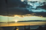
Drove by the ocean side as the clouds moved away, revealing the setting sun at 9PM.
What a beautiful day.

These few days by far was my favorite of the entire 15 days on the road. Filled with scenery, wild animals, and just plenty of relax and chill time.

Southcentral Alaska has been magical to me, and I will come back for more!
(with more $$ to spend, that is. Still need to charter a boat to go fishing, visit Kenai Fjords Natl Park, go see bears fishing, go kayaking)
Funny story: Kenai Fjords Natl Park Visitor Center is in Seward and I passed by it. I thought about getting my NPS passport stamp there but decided not to. I haven't been and that's one thing I didn't want to cheat.
 

TSL

Well-Known Member
Joined
Dec 20, 2021
Messages
245
Reaction score
246
Location
Oregon
Really enjoying your posts - what an amazing trip so far ! Missed you when you came through Oregon, I would have reached out to see if we could meet up but I was in California at the time! ( NorCal - father-in-law lives by Clear Lake in Lake County, couple hours north of Napa, and west of Sacramento. We did a family road trip down US101 down the Oregon coast and on down through the redwoods while you were tearing it up heading north ! )
I recall we saw our first black bear in BC, somewhere up the Fraser canyon before we gotten very far at all. We saw plenty more in BC, but oddly didn't see any in Alaska.
You mentioned CB radio a few posts back : when we were up there we did a one-day tour bus thing up the Dalton highway. I do recall that the driver had a CB radio and he would periodically call out his position ( "white tour bus northbound at mile xx" or something like that ) The big rigs that drive that road take no prisoners ! Somewhat similar to in the forests here in the Pacific NW, you'll often see a "CB Channel XX" posted at the end of the road. If there's active logging, there might be log trucks thundering down the road and having a CB is a good idea to know when they are coming your way. I don't have one, I'm usually out there on the weekends though so it doesn't matter. My neighbor is a retired forestry guy and has filled me on some of the details. Interesting detail I learned from him recently : the log transporter trucks can handle up to a 18% grade, coming downhill with a load of logs ! The steepest road they would build in oregon at least would be a 22% grade. Above 18% they consider it an "assist" for the trucks, so they have a dozer to push them up / hold them back on the way down !

Your trip report here is making me want to do the Alaska road trip again !
My mother-in-law lived in Cordova for a few years. Fishing village down the coast. Only way in or out was by plane or boat. They used to take a trip to Costco in Anchorage every few weeks. They would get the ferry to Whittier ( the Alaska Marine Highway I think it's called ), go through the tunnel and head for Anchorage. My wife spent some summers down there in Cordova. Seeing grizzlies was not uncommon apparently !
 

Users who are viewing this thread

Site Vendors

https://www.jasonlewisautomotive.com/

Staff online

Top